The Karagiye Depression
The Karagiye Depression, also known as the Karagiye Lowland or Karagiye Hollow, is a geological feature located in the western part of Kazakhstan.
Here are some key details about the Karagiye Depression:
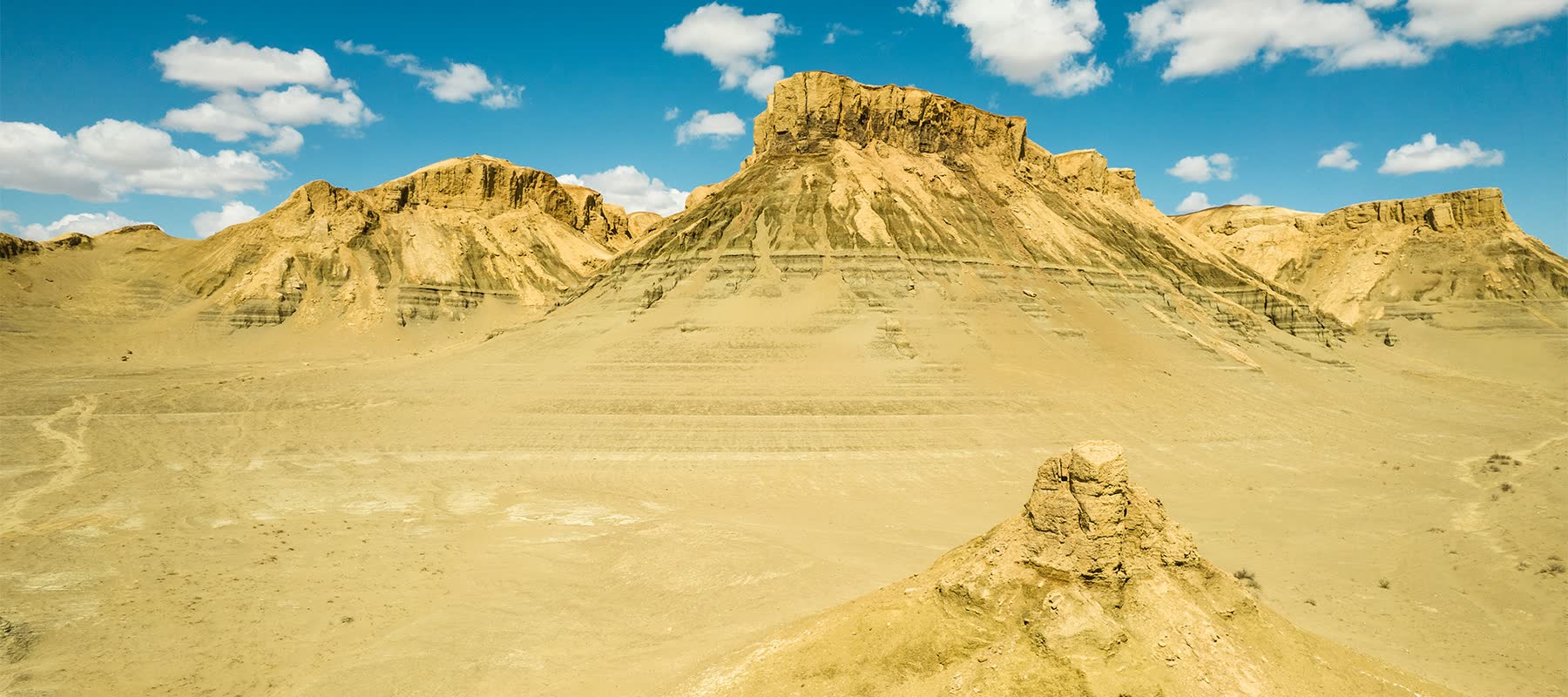
Location: The Karagiye Depression is situated in western Kazakhstan, primarily in the Mangystau Region. It is part of the larger Caspian Depression, which encompasses a vast low-lying area in the region.
Geological Formation: The depression is characterized by its low elevation and flat landscape. It is primarily a lowland or basin, with a terrain that is lower in elevation compared to the surrounding areas.
Size and Extent: The Karagiye Depression covers a significant area, and its size can vary depending on the specific geographic boundaries defined. It is part of the larger geological structure known as the Caspian Depression.
Climate and Environment: The region's climate can vary, but it is often arid and characterized by semi-desert or desert conditions. The Caspian Sea, located to the west, has a significant influence on the climate and environment of the region.
Natural Resources: The area may contain natural resources, including oil and gas deposits. Kazakhstan, in general, is known for its energy resources, and exploration and extraction activities can be found in various regions, including those within the Caspian Depression.
Tourism and Recreation: The flat and remote landscape of the Karagiye Depression may not be a major tourist destination, but the region's natural beauty and unique geological features can attract some visitors interested in exploring its unique environment.
The Karagiye Depression is a part of the broader Caspian Depression and contributes to the diverse geological and geographical features of western Kazakhstan. It is known for its arid conditions and its significance in the context of natural resource exploration in the region.
RELATED DESTINATIONS

The Naryn Desert, also known as the Naryn-Kala Desert, is a desert located in Kazakhstan, primarily in the western part of the country. The Naryn Desert is situated in western Kazakhstan, near the border with Uzbekistan. It is part of the vast Central Asian desert region.

The Caspian Sea is the world's largest inland body of water, and it is often referred to as a "sea" due to its size and characteristics, even though it is technically a lake. Russia to the north, Kazakhstan to the northeast, Turkmenistan to the east, Iran to the south, and Azerbaijan to the southwest. It is situated between Europe and Asia.

Balaoiyk Cave, also known as Balayuk Cave, is a relatively recent geological discovery and is often referred to as the miracle of Ustyurt. Balaoiyk Cave is situated in the south-eastern part of the Ustyurt Plateau, near the border with the Republic of Uzbekistan.